

Creag an Sgliata [Sron na h-Iolaire]
Good walks are even better shared.
Overview
Creag an Sgliata [Sron na h-Iolaire]
Creag an Sgliata, straddling the fine line between remarkable majesty and downright stubbornness, is a Munro that welcomes those willing to conquer its slopes. Rising to 915 meters, it promises all the classic Highland experiences you crave.
Geology
This beauty is formed principally from a mix of metamorphic rocks, such as schists and gneisses. Their rugged charm provides a stunning visual experience − just check your footing, as a rogue stone could send you into a dance!
Access and Facilities
Getting to Creag an Sgliata isn't a bother. The nearest parking spot lies at Auchmore, where friendly locals have set aside space for about 6-8 vehicles. While the public transport is a bit sparse, Taynuilt is the closest town (about 7 miles away), offering cafes and basic facilities to prep your appetite for the hike ahead.
Route Information
Trail from Auchmore
The route begins at Auchmore, entailing a 9.5-kilometre trek to the peak. With a moderate difficulty rating, it's a hike you may finish without invoking the wrath of your knees. Expect stunning views and a few photo opportunities along the way (especially of your mates caught mid-breath). It generally takes around 4 hours to complete, so plan ahead at your own pace!
Summit Features
Once you've reached the summit, a proud trig point and a charming cairn await. These landmarks provide a sense of accomplishment, and perfect backdrops for those classic 'I made it!' photos that are almost mandatory.
Views
From the top, prepare your eyes for spectacular views! Witness Loch Awe stretching out to the south, greeted by the jagged majesty of surrounding peaks. If conditions are just right, even Ben Cruachan might show up, flaunting its snowy crown. For the best experience, visit during spring, summer, or the majestic autumn months.
Hazards
With outdoor adventures come a few risks. Be wary of the ever-changing Scottish weather, the steep rocky portions, and, of course, those muddy patches strategically placed to challenge your balance.
Nearby Summits
If you fancy an extended trip, be sure to check out Beinn a' Chochuill and Beinn Eunaich, both standing tall nearby. Not only do they offer additional trails to tackle but also aid in extending your Instagram portfolio with more stunning landscape shots.
In conclusion, Creag an Sgliata promises a delightful escape into Scotland’s wild heart. So lace up those boots, pack an extra sandwich, and get ready to take on the adventure of a lifetime!
Happy hiking!
Explore routes near Creag an Sgliata [Sron na h-Iolaire]
Public walks starting within 80 km of this hill. Nearby does not mean a route reaches the summit; check its map and access before setting out.
Kenmore: Drummond Hill Black Rock Trail above Loch Tay
View route
Aberfeldy: Glassie Woodland and River Tay Circular
View route
Crieff: Lady Mary's Walk and the River Earn
View route
Killin: Falls of Dochart, Finlarig and Moirlanich Longhouse
View route
Route planning notes
These notes describe possible approaches, not verified navigable routes or permission to cross land. Check current paths, local access rules and conditions before setting out.
Trail from Auchmore
A scenic route leading from Auchmore, offering gradual ascents and stunning views as you approach the summit.
Make a day of it, together
Find someone to share the walk with, or organise a day out along a route you like.
Photo Gallery
View all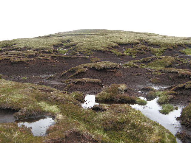 Photo could not load
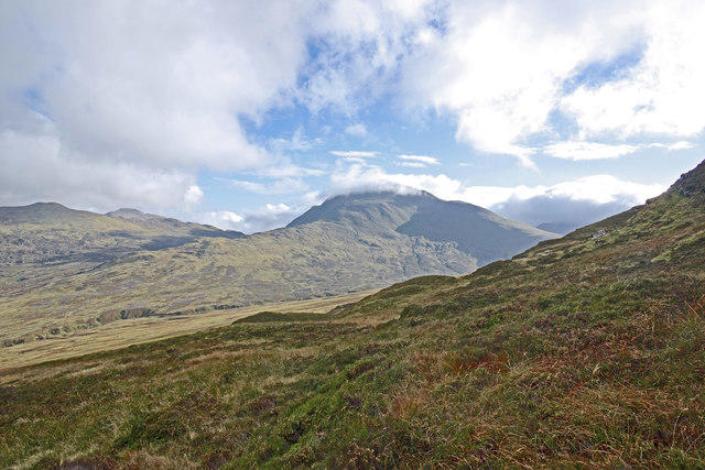
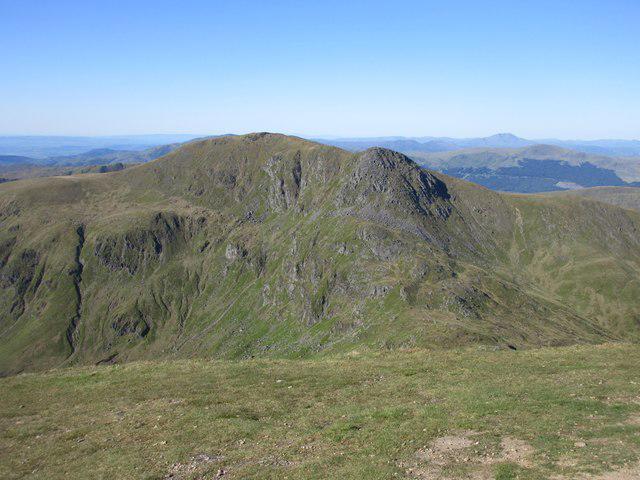
NN7639 : Bogs, Creag an Sgliata
Richard Webb
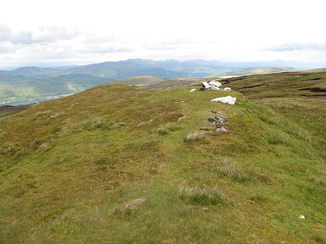 Photo could not load
NN7639 : Creag an Sgliata
Richard Webb
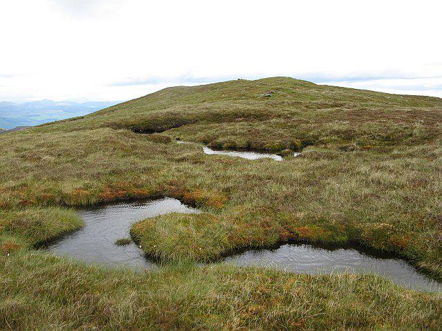 Photo could not load
NN7639 : Creag an Sgliata
Richard Webb
Hill facts and local notes
Classifications
Elevation
697m
2,287 ft
Prominence
103m
Coordinates
56.5349, -4.0019
NN769398
OS Map
51 52
Explorer: OL48E 378E 379W
At the Summit
At the summit, you’ll find a noticeable trig point and an impressive cairn, which provide excellent photo opportunities to catch your hiking buddies unaware as they pose awkwardly for the camera.
Terrain & Geology
The mountain is primarily composed of metamorphic rocks, including schists and gneisses, characteristic of the region's ancient geological history. This complex formation gives the mountain its rugged aesthetic, perfect for those keen on studying geology or simply enjoying some rocky formations.
Views & Scenery
From the summit, gaze across the expansive vistas of Loch Awe to the south and the jagged peaks of the surrounding Highlands. On a clear day, Ben Cruachan can also be spotted proudly wearing its snowcap.
History & Heritage
Name Origin
Creag an Sgliata means 'Crag of the Sliotar', where Sliotar refers to a smooth ball used in the Gaelic sport of hurling; a nod to the local Gaelic heritage.
Historical Significance
This mountain holds cultural significance in the Gaelic community, embodying local folklore and serving as a landmark for generations of hikers and climbers.
Getting There & Facilities
Check current local access restrictions, parking rules and transport timetables before travelling. These notes do not confirm public access to the summit.
Parking
The nearest parking is located at Auchmore, where there is a small car park with space for around 6-8 cars. Please park considerately and avoid obstructing any access.
Public Transport
Public transport options are limited, so it's advisable to drive or use a taxi service from nearby towns such as Taynuilt or Oban.
Nearby Facilities
Facilities in Taynuilt include a couple of cafes for a hearty meal and public toilets—just make sure to plan ahead as there's little available once you set off on your adventure.
Safety Information
Known Hazards
- Potential for sudden weather changes, steep rocky sections, and the ever-present opportunity to slip in mud.
General Safety Tips
- Check weather conditions before setting out
- Carry appropriate clothing and equipment
- Let someone know your planned route
- Take a map, compass, and GPS device
- Carry emergency supplies: food, water, first aid kit, torch
Hills
Some common questions about the hills answered
Are there group walks up Creag an Sgliata [Sron na h-Iolaire]?
Many walkers use Walkmates to join or organise walks with others. You can check for group walks around Creag an Sgliata [Sron na h-Iolaire] through the maps
Are there other walkers around Creag an Sgliata [Sron na h-Iolaire]?
Activity varies by location and time, but Walkmates lets you see whether others have shared walks or shown interest in this area. Find other people through the walking friends search walking friends for Creag an Sgliata [Sron na h-Iolaire] search or of course create your own walk for Creag an Sgliata [Sron na h-Iolaire]
Can I organise a walk to Creag an Sgliata [Sron na h-Iolaire]?
Yes. If there aren’t any walks listed already, you can create a walk and make it available for others to join.
If you're signed up to Walkmates, you can create a walk to Creag an Sgliata [Sron na h-Iolaire].
How do I find a walk up this hill?
There are often multiple ways to walk this hill, depending on experience and route preference. Walkmates helps you explore walks and routes that others have shared.
Can I suggest a new route up Creag an Sgliata [Sron na h-Iolaire]?
Yes. You can suggest or create routes to share with others. Walkmates focuses on the social side of walking, so routes are used to help people organise walks and explore areas together, rather than as detailed navigation tools or route libraries.
Other uses really appreciate knowledgeable walkers sharing their routes. Share your favourite route to Creag an Sgliata [Sron na h-Iolaire] here
The is an error or something incorrect about this hill. How do I let you know?
We always strive to keep the information on Walkmates as accurate as possible. If you find an error, please let us know through the contact form and we'll aim to correct it as quickly as possible
Community Discussion
Comments
Location
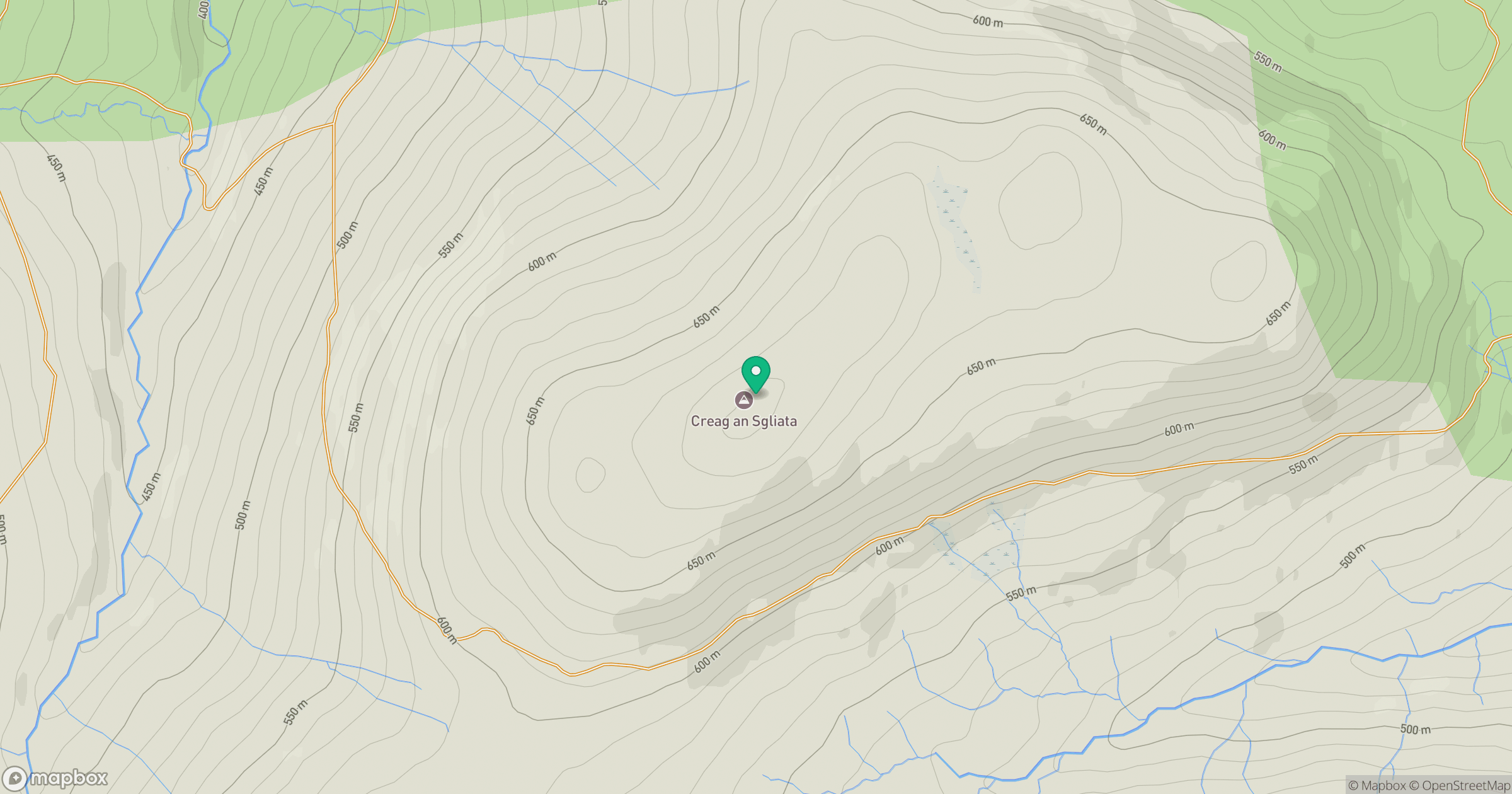
Grid reference: NN769398
View on OpenStreetMapOpens a map in a new tab, centred on the hill.
Hills within 30 km
Straight-line distance, not a walking route or confirmation of access.
No comments yet. Be the first.